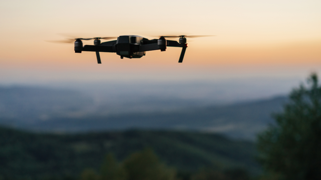
The construction and surveying industries have come a long way from the days of manual site inspections, tripods, and painstaking measurements. Drones have become game-changers, bringing unprecedented accuracy, efficiency, and cost savings to professionals in these fields.
Fast forward to 2025, and the technology has only gotten better. With AI-driven analytics, LiDAR sensors capable of detecting millimetre-level changes, and longer battery life for extended aerial mapping, modern drones are more than just flying cameras—they’re precision tools for mapping, project management, and infrastructure planning.
But with so many options on the market, how do you know which drone is right for your project? In this guide, we’ll explore the best drones for construction and surveying in 2025, breaking down their features, capabilities, and how they fit into real-world scenarios.
The Role of Drones in Construction & Surveying
“Drones take the grunt work out of surveying while providing data that’s 10 times more accurate.”
Drones aren’t just fancy toys for tech enthusiasts. They have transformed the way engineers, surveyors, and project managers work. Whether it’s monitoring a high-rise project in Sydney or mapping an outback mining site, drones are doing the heavy lifting—literally and figuratively.
Here’s how drones are revolutionising construction and surveying:
• Topographic Mapping & Land Surveys: Traditional surveying methods take days, but drones can capture high-resolution data in hours.
• Site Inspections & Monitoring: Instead of sending workers into risky environments, drones provide a bird’s-eye view.
• Stockpile & Volume Measurement: Estimating material quantities manually can lead to errors—drones automate and refine the process.
• Project Planning & Management: Aerial data improves decision-making, ensuring projects stay on track and within budget.
Key Features to Consider in a Surveying Drone
“Not all drones are created equal. The right one depends on what you need it for.”
Before investing in a drone, here are the must-have features for construction and surveying:
- RTK/PPK Positioning: If you need precise maps, drones with Real-Time Kinematic (RTK) and Post-Processed Kinematic (PPK) positioning are a must. They offer sub-centimetre accuracy, eliminating guesswork.
- LiDAR & Photogrammetry Capabilities: LiDAR sensors allow drones to map dense vegetation and uneven terrain, while photogrammetry software helps stitch high-resolution images into detailed site models.
- Flight Time & Battery Life: Longer flights mean less downtime swapping batteries—ideal for large construction sites.
- Durability & Weather Resistance: Australian conditions can be brutal, so a good drone should handle heat, wind, and dust with ease.
- Autonomous Flight Modes: Pre-programmed flight paths mean the drone can do its job without constant manual control.
Best Drones for Construction & Surveying in 2025
Here are the top drones making waves in surveying and construction this year:
DJI Matrice 350 RTK
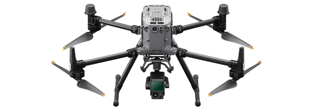
Why it’s great: The Swiss Army knife of surveying drones.
• RTK positioning for ultra-precise mapping
• High payload capacity for LiDAR & multispectral cameras
• 55-minute flight time for extended site coverage
Best for: Large infrastructure projects needing precision surveys.
Quantum Systems Trinity F90+
Why it’s great: A fixed-wing beast built for long-range surveying.
• 90-minute flight time – unmatched in its class
• PPK processing for ultra-accurate aerial data
• Fixed-wing design means greater range per flight
Best for: Surveying vast landscapes like mining sites or farmland.
WingtraOne GEN II
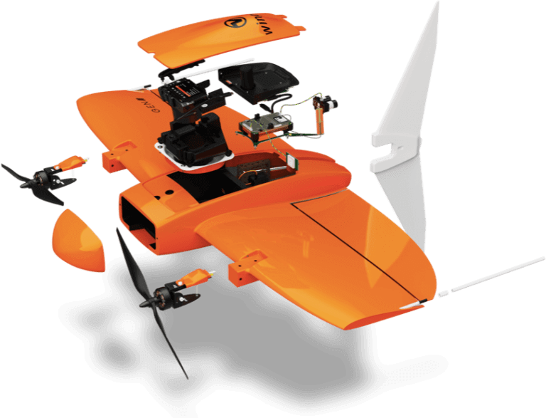
Why it’s great: Takes off like a drone, flies like a plane.
• VTOL (Vertical Take-Off and Landing) for tough terrain
• 42MP camera for crystal-clear aerial imagery
• Dual payload support for high-resolution mapping
Best for: High-resolution photogrammetry in remote locations.
Parrot Anafi Ai
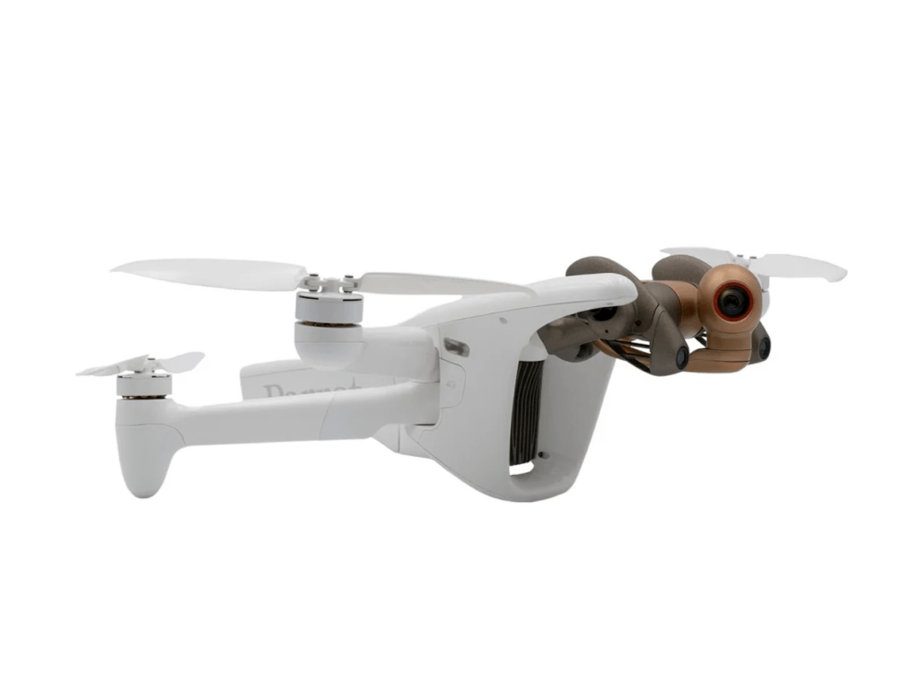
Why it’s great: AI-driven mapping meets portable design.
• 4G connectivity for remote data transfers
• AI-assisted photogrammetry for precision mapping
• Lightweight and foldable – easy to carry around
Best for: On-the-go mapping for construction managers.
Autel Robotics EVO Max 4T
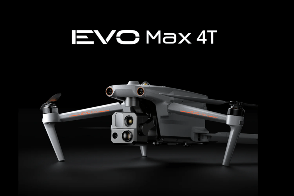
Why it’s great: Multi-sensor tech for all conditions.
• Thermal imaging for infrared inspections
• Anti-interference tech for stable long-range flights
• Long-range transmission system
Best for: Inspections & monitoring in urban environments.
Advantages of Using Drones in Construction & Surveying
“Drones don’t just save money—they save lives.” – Site supervisor, Perth.
- Faster Surveys: What used to take weeks now takes hours.
- Cost Savings: Fewer site visits mean less money spent on labour.
- Higher Accuracy: RTK/PPK ensures sub-centimetre precision.
- Improved Safety: No need for workers to climb scaffolding or enter hazardous areas.
- Environmental Benefits: Less ground disturbance compared to traditional survey methods.
Challenges & Future of Drone Technology in Construction
Of course, no technology is perfect. Drones face challenges such as:
• Regulations: CASA (Civil Aviation Safety Authority) has strict rules for drone use.
• High Initial Costs: Professional-grade drones aren’t cheap.
• Data Overload: Large volumes of aerial data require proper processing.
But what’s next? AI-powered drones could soon detect structural issues before they happen, making construction sites safer and more efficient.
Frequently Asked Questions (FAQ)
Q: Are drones legal for surveying in Australia?
Yes, but commercial operators must comply with CASA regulations.
Q: What is the most accurate drone for mapping?
Drones with RTK & PPK technology, like the DJI Matrice 350 RTK, offer sub-centimetre accuracy.
Conclusion
Drones have become essential tools in construction and surveying. The right UAV can save time, cut costs, and improve project accuracy. If you’re in the industry, investing in one is a smart move.