FAQ
How do drones enhance disaster response efforts?
Drones provide rapid aerial assessments, real-time data, and access to hazardous areas, significantly improving the efficiency and safety of disaster response operations.
Can drones operate in all disaster conditions?
While drones are versatile, their operation can be limited by extreme weather conditions such as heavy rain, strong winds, or dense smoke.
What types of data can drones collect during disasters?
Drones can capture high-resolution imagery, thermal imaging, and LiDAR data, aiding in damage assessment, search and rescue, and firefighting efforts.
Are drone operations regulated during emergency situations?
Yes, drone operations are subject to regulations, even during emergencies. Operators must adhere to guidelines set by aviation authorities to ensure safety and compliance.
How do drones assist in search and rescue missions?
Equipped with thermal cameras and sensors, drones can quickly locate individuals in challenging terrains or conditions, expediting rescue efforts.
Introduction
Australia’s unpredictable weather patterns, including bushfires, floods, and cyclones, demand a swift and efficient disaster response. The recent Cyclone Megan, which tore through Northern Australia, left significant devastation in its wake, highlighting the need for rapid assessment and relief efforts.
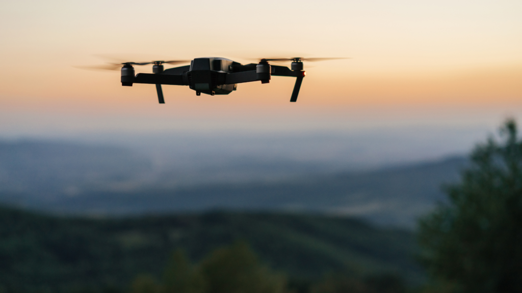
Drones have become a game-changer in emergency management. These Unmanned Aerial Vehicles (UAVs) provide critical real-time data, assist in search and rescue missions, and streamline damage assessments. As emergency responders continue to leverage drone technology, Australia is witnessing a transformation in how disasters are managed.
The Role of Drones in Disaster Response
Rapid Damage Assessment
In the aftermath of a disaster like Cyclone Megan, assessing the extent of damage is crucial for effective resource allocation. Drones provide aerial surveillance in real-time, allowing emergency teams to prioritise the hardest-hit areas.
Search and Rescue Operations
Drones equipped with thermal imaging cameras can detect heat signatures of stranded individuals, even in dense bushland or floodwaters. This capability drastically reduces search times and increases survival chances.
Firefighting Support
During bushfires, drones assist firefighters by tracking fire movements, identifying hotspots, and detecting flare-ups before they become uncontrollable. This data helps firefighting teams plan their strategies more effectively.
Advantages of Using Drones in Emergencies
Enhanced Safety for Personnel
Drones eliminate the need for emergency responders to physically enter hazardous areas, such as unstable buildings or flooded regions, reducing the risk to human lives.
Cost and Time Efficiency
Compared to traditional aerial surveys using helicopters, drones are cheaper, faster, and can operate in areas where manned aircraft cannot fly.
Access to Hazardous or Inaccessible Areas
Flooded roads, landslides, and collapsed buildings can prevent ground teams from reaching affected areas. Drones fly over these obstacles with ease, providing real-time updates to decision-makers.
Implementing Drone Technology in Disaster Management
Training and Certification
Operating drones for emergency management requires specialised training. Australian organisations are now offering courses that prepare operators for disaster scenarios, ensuring effective use of drone technology.
Regulatory Considerations
Drone use in disaster response must comply with CASA (Civil Aviation Safety Authority) regulations. Emergency teams often require special permits for drone flights in restricted areas.
Integration with Existing Emergency Services
Drones are most effective when integrated with traditional disaster response methods. Emergency agencies, local councils, and drone operators must collaborate to maximise efficiency.
Why You Should Choose Two70° Drone Survey & Services
At Two70°, we specialise in drone surveys and aerial inspections for disaster response and recovery. Our experienced team operates state-of-the-art drones with high-resolution imaging and thermal capabilities, ensuring precise damage assessments.
When disaster strikes, every second counts. Our services are tailored to provide rapid response solutions that assist emergency teams in making informed decisions. With a strong understanding of Australia’s unique disaster challenges, we are committed to supporting communities in their time of need.
Why You Should Choose Two70° Drone Survey & Services
From bushfires and cyclones to floods and landslides, drones are proving to be an indispensable tool in Australia’s emergency response efforts. Their ability to gather real-time data, assist in search and rescue, and streamline recovery operations makes them an essential asset in disaster management.
Call to Action
Are you looking for reliable drone survey and assessment services for disaster response? Two70° Drone Survey & Services is ready to help. Our cutting-edge technology, experienced operators, and rapid response capabilities ensure you get the most accurate data when it matters most.
Contact us today to learn how we can assist in disaster recovery efforts and emergency preparedness.