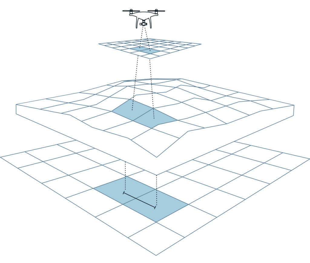
Understanding Ground Sampling Distance (GSD) and Its Importance in Drone Surveys
Ground Sampling Distance (GSD) is a crucial metric in the world of drone surveying, defining the distance between the centres of two consecutive pixels on the ground. In simpler terms, GSD indicates the level of detail that can be captured in an image taken by a drone. For example, a GSD of 5 cm means that each pixel in the image represents a 5 cm by 5 cm area on the ground. Why is GSD Important? GSD directly impacts the
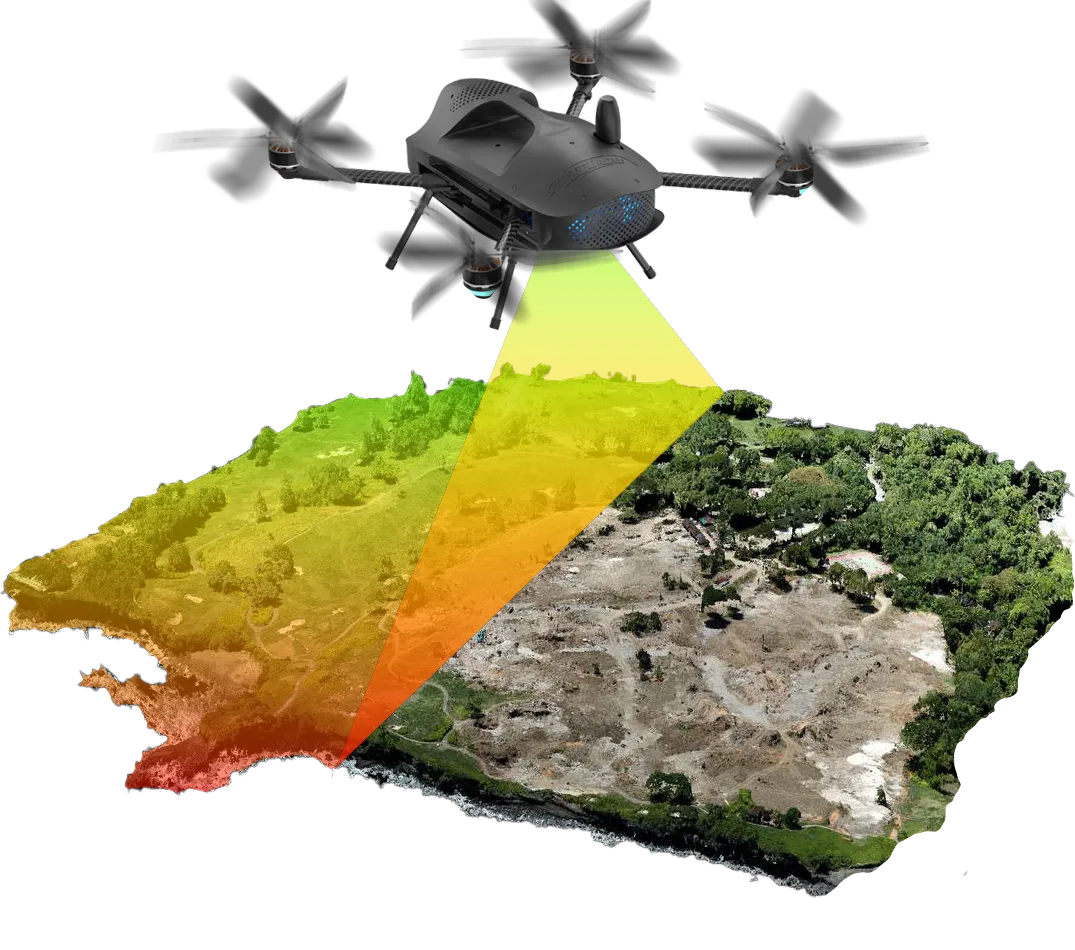
Photogrammetry vs. LiDAR: Understanding the Differences in Technology, Costs, and Deliverables
In the realm of drone surveying, two primary technologies dominate the field: Photogrammetry and LiDAR (Light Detection and Ranging). Both have unique strengths, costs, and deliverables, making them suitable for different use cases. At Two70° Drone Survey and Services, we leverage both technologies to provide our clients with the most accurate and detailed data possible. In this blog post, we’ll explore the key differences between Photogrammetry and LiDAR, along with their respective costs and applications. Photogrammetry TechnologyPhotogrammetry involves capturing multiple
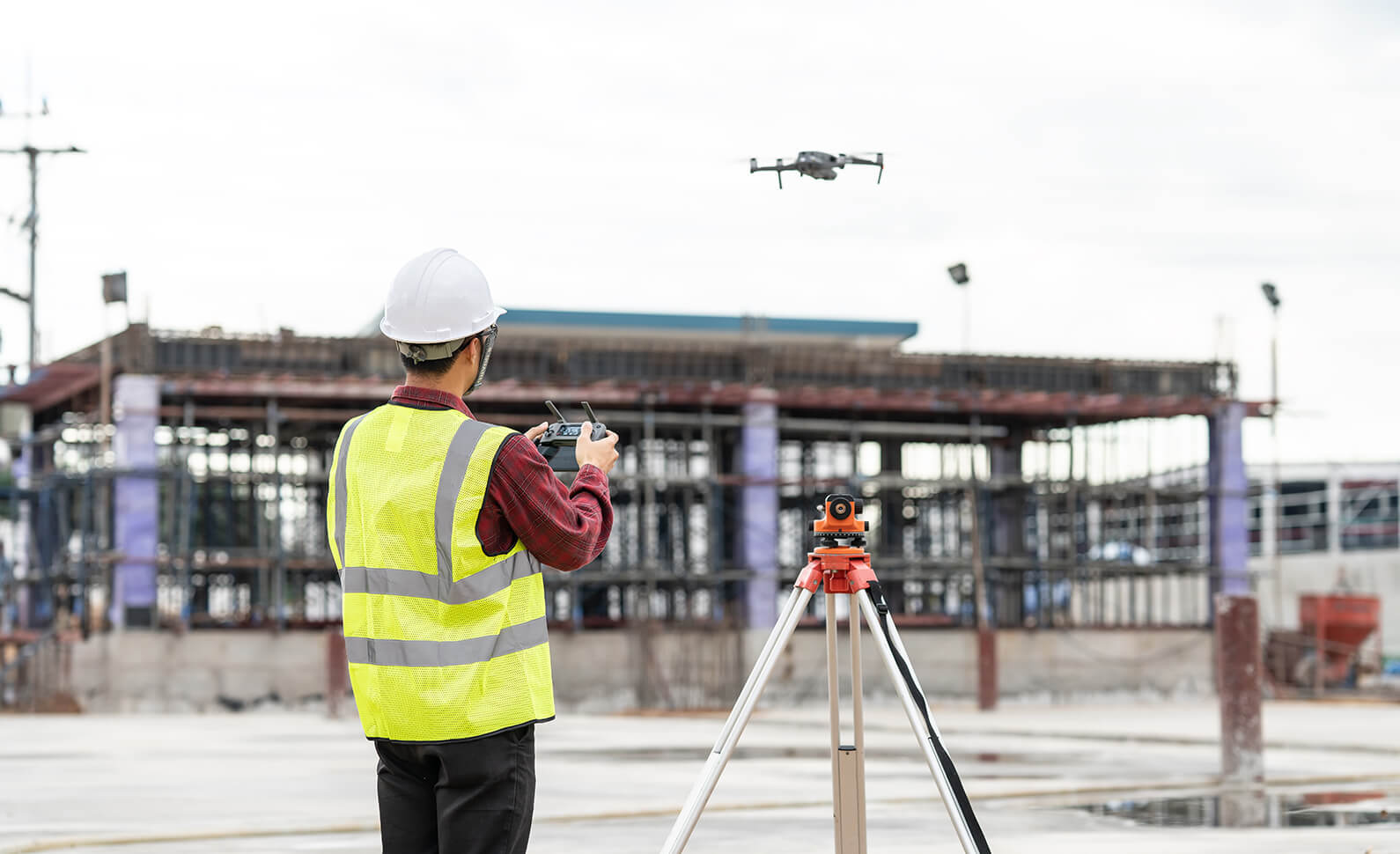
The Importance of Using an Experienced Drone Company for Surveys
In the rapidly evolving world of technology, drones have revolutionised the way we conduct surveys. From mapping large terrains to inspecting critical infrastructure, drones offer unparalleled precision and efficiency. However, it’s crucial to understand that not all drone services are created equal. Engaging an experienced drone company for your surveying needs is vital for several reasons. The Professional Edge Drone surveying is not just about flying a drone and capturing images. It’s a professional service that requires a deep understanding
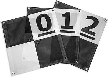
Ground control points (gcps) & checkpoints?
In the realm of geospatial analysis and remote sensing, Ground Control Points (GCPs) and Checkpoints play a crucial role in ensuring the accuracy and reliability of data collected from various surveying methods, particularly aerial surveys using drones and LiDAR. This blog post will delve into what GCPs and Checkpoints are, their importance, and how they are used and collected. Ground Control Points (GCPs) Definition:Ground Control Points are specific locations on the Earth’s surface with known geographic coordinates. These points are
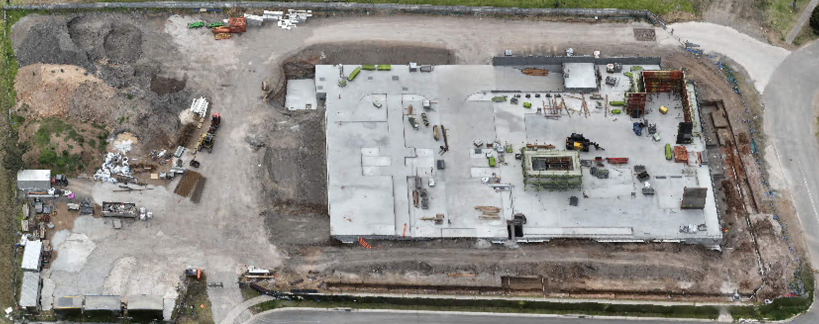
From aerial surveying to the deliverables
Discover the fascinating journey of construction site development. Explore the intricacies of capturing detailed photos, allowing you to zoom in and extract every necessary detail. Our drone survey services offer a unique perspective, providing you with tailored deliverables to meet your specific needs. The image above captures the culmination of our surveying efforts, presenting a meticulously crafted replica of a construction site. Specifically tailored to our customer’s requirements, this deliverable serves a multitude of purposes: – Replicating the current project
Listening to your needs: introducing matrice m350 rtk with lidar capability
At Two70° Drone Survey and Services, we pride ourselves on listening to our customer’s needs and striving to provide innovative solutions. With this commitment in mind, we are thrilled to announce the latest addition to our fleet: the Matrice M350 RTK with LiDAR capability. Our goal is to continually invest in cutting-edge technology that directly addresses the challenges our clients face, ensuring we deliver results that exceed expectations. Why LiDAR? LiDAR (Light Detection and Ranging) technology has emerged as a
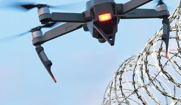
Enhance Your Asset Security with Two70° Drone Services
At Two70° Drone Survey and Services, we are excited to...
Read More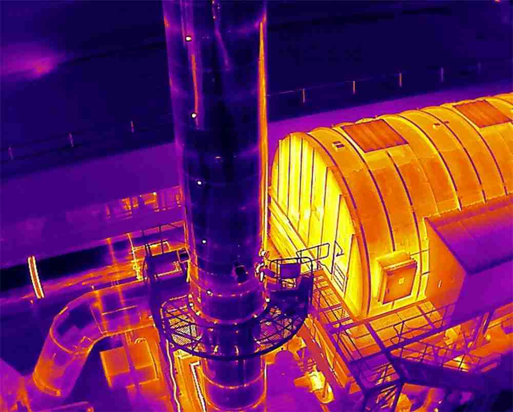
Seeing the Unseen: How Advanced Drones with Thermal Imaging Are Revolutionizing Surveys and Inspections
Here at Two70° Drone Survey and Services, we’re constantly pushing...
Read More
We Acquired CASA ReOC Operator Certificate: A Milestone in Professional Drone Operations
Why the CASA ReOC Certificate Matters We are thrilled to...
Read More
The Importance of Using Enterprise Drones for Professional Projects
In today’s rapidly evolving world, drone technology has become an...
Read More
Why Tier 1 Construction Companies Should Use Professional Drone Survey Operators
In the fast-evolving construction industry, the integration of advanced technologies...
Read More