Enhance Your Asset Security with Two70° Drone Services
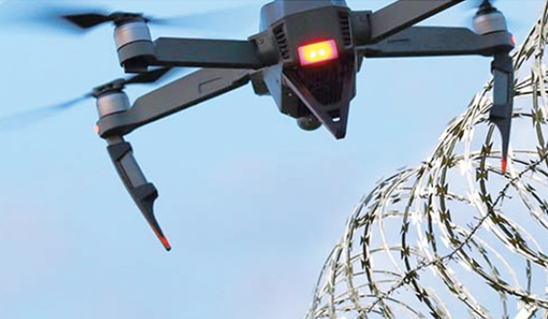
At Two70° Drone Survey and Services, we are excited to offer a cutting-edge solution for sites and asset security: drone-based monitoring services that go beyond traditional surveillance. With a focus on asset , perimeter security and site monitoring, our drones provide a versatile and cost-effective way to protect assets all year round. As a certified […]
Seeing the Unseen: How Advanced Drones with Thermal Imaging Are Revolutionizing Surveys and Inspections
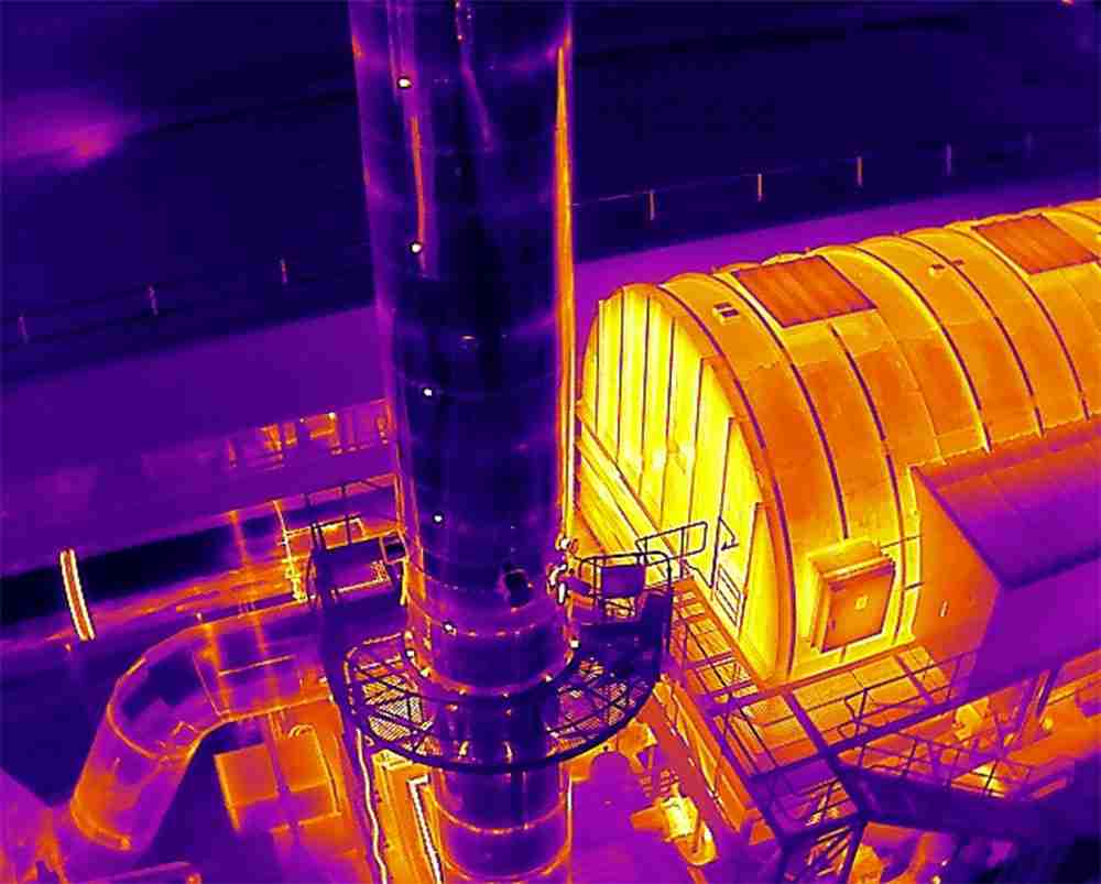
Here at Two70° Drone Survey and Services, we’re constantly pushing the boundaries of what’s possible with drone technology. Today, we’d like to delve into the exciting world of drone thermal surveys. This innovative technique uses advanced drones equipped with thermal imaging cameras to capture data beyond the visible spectrum. What is a Drone Thermal Survey? […]
We Acquired CASA ReOC Operator Certificate: A Milestone in Professional Drone Operations

Why the CASA ReOC Certificate Matters We are thrilled to announce that Two70° Drone Survey and Services has recently acquired a CASA ReOC (Remote Operator Certificate) operator certificate. This significant achievement sets us apart from standard drone operators and reinforces our commitment to delivering the highest standards of safety, precision, and professionalism in our drone […]
The Importance of Using Enterprise Drones for Professional Projects

In today’s rapidly evolving world, drone technology has become an indispensable tool across various industries. While cheap entry-level drones may seem appealing due to their affordability and basic capabilities, they fall short in meeting the rigorous demands of professional projects. At Two70° Drone Survey & Services, we emphasize the importance of using enterprise-grade drones for […]
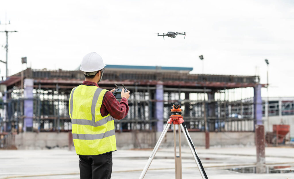
Why Tier 1 Construction Companies Should Use Professional Drone Survey Operators

In the fast-evolving construction industry, the integration of advanced technologies is paramount to maintaining a competitive edge. Among these technologies, drones have emerged as a game-changer, offering unparalleled benefits for surveying, mapping, and inspections. While some Tier 1 construction companies may consider developing an in-house drone department, partnering with a professional drone survey operator offers […]
Why Companies Should Embrace Drone Services

In today’s fast-paced and technology-driven world, companies across various industries are continuously seeking innovative solutions to enhance their operations, ensure safety, and save costs. One such groundbreaking solution is the adoption of drone services for mapping, surveying, Geographic Information Systems (GIS), and asset inspection. At Two70° Drone Survey and Services, we have witnessed firsthand the […]
Understanding Ground Sampling Distance (GSD) and Its Importance in Drone Surveys
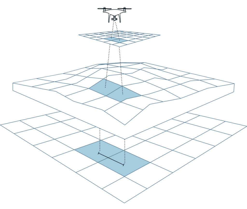
Ground Sampling Distance (GSD) is a crucial metric in the world of drone surveying, defining the distance between the centres of two consecutive pixels on the ground. In simpler terms, GSD indicates the level of detail that can be captured in an image taken by a drone. For example, a GSD of 5 cm means […]
Photogrammetry vs. LiDAR: Understanding the Differences in Technology, Costs, and Deliverables
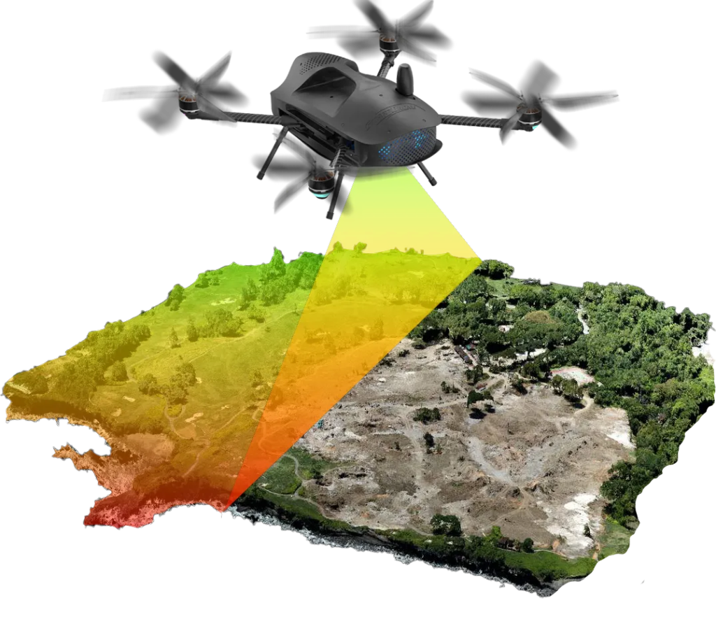
In the realm of drone surveying, two primary technologies dominate the field: Photogrammetry and LiDAR (Light Detection and Ranging). Both have unique strengths, costs, and deliverables, making them suitable for different use cases. At Two70° Drone Survey and Services, we leverage both technologies to provide our clients with the most accurate and detailed data possible. […]
The Importance of Using an Experienced Drone Company for Surveys
In the rapidly evolving world of technology, drones have revolutionised the way we conduct surveys. From mapping large terrains to inspecting critical infrastructure, drones offer unparalleled precision and efficiency. However, it’s crucial to understand that not all drone services are created equal. Engaging an experienced drone company for your surveying needs is vital for several […]
Ground control points (gcps) & checkpoints?
In the realm of geospatial analysis and remote sensing, Ground Control Points (GCPs) and Checkpoints play a crucial role in ensuring the accuracy and reliability of data collected from various surveying methods, particularly aerial surveys using drones and LiDAR. This blog post will delve into what GCPs and Checkpoints are, their importance, and how they […]